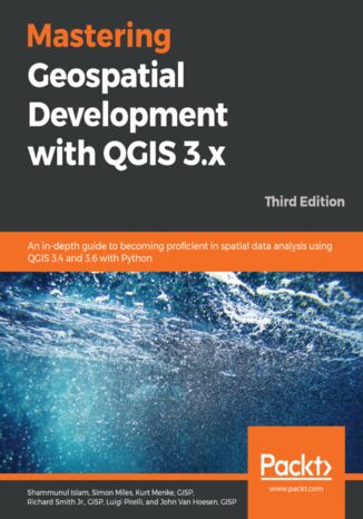
Mastering Geospatial Development with QGIS 3.x. An in-depth guide to becoming proficient in spatial data analysis using QGIS 3.4 and 3.6 with Python - Third Edition Shammunul Islam, Simon Miles, Kurt Menke, GISP, Richard Smith Jr., GISP, Luigi Pirelli, John Van Hoesen, GISP

- Autorzy:
- Shammunul Islam, Simon Miles, Kurt Menke, GISP, Richard Smith Jr., GISP, Luigi Pirelli, John Van Hoesen, GISP
- Wydawnictwo:
- Packt Publishing
- Ocena:
- Stron:
- 466
- Dostępne formaty:
-
PDFePubMobi
Opis
książki
:
Mastering Geospatial Development with QGIS 3.x. An in-depth guide to becoming proficient in spatial data analysis using QGIS 3.4 and 3.6 with Python - Third Edition
QGIS is an open source solution to GIS and widely used by GIS professionals all over the world. It is the leading alternative to proprietary GIS software. Although QGIS is described as intuitive, it is also, by default, complex. Knowing which tools to use and how to apply them is essential to producing valuable deliverables on time.
Starting with a refresher on the QGIS basics and getting you acquainted with the latest QGIS 3.6 updates, this book will take you all the way through to teaching you how to create a spatial database and a GeoPackage. Next, you will learn how to style raster and vector data by choosing and managing different colors. The book will then focus on processing raster and vector data. You will be then taught advanced applications, such as creating and editing vector data. Along with that, you will also learn about the newly updated Processing Toolbox, which will help you develop the advanced data visualizations. The book will then explain to you the graphic modeler, how to create QGIS plugins with PyQGIS, and how to integrate Python analysis scripts with QGIS.
By the end of the book, you will understand how to work with all aspects of QGIS and will be ready to use it for any type of GIS work.
Wybrane bestsellery
Shammunul Islam, Simon Miles, Kurt Menke, GISP, Richard Smith Jr., GISP, Luigi Pirelli, John Van Hoesen, GISP - pozostałe książki
Packt Publishing - inne książki
Dzięki opcji "Druk na żądanie" do sprzedaży wracają tytuły Grupy Helion, które cieszyły sie dużym zainteresowaniem, a których nakład został wyprzedany.
Dla naszych Czytelników wydrukowaliśmy dodatkową pulę egzemplarzy w technice druku cyfrowego.
Co powinieneś wiedzieć o usłudze "Druk na żądanie":
- usługa obejmuje tylko widoczną poniżej listę tytułów, którą na bieżąco aktualizujemy;
- cena książki może być wyższa od początkowej ceny detalicznej, co jest spowodowane kosztami druku cyfrowego (wyższymi niż koszty tradycyjnego druku offsetowego). Obowiązująca cena jest zawsze podawana na stronie WWW książki;
- zawartość książki wraz z dodatkami (płyta CD, DVD) odpowiada jej pierwotnemu wydaniu i jest w pełni komplementarna;
- usługa nie obejmuje książek w kolorze.
Masz pytanie o konkretny tytuł? Napisz do nas: sklep@ebookpoint.pl
Książka drukowana











Oceny i opinie klientów: Mastering Geospatial Development with QGIS 3.x. An in-depth guide to becoming proficient in spatial data analysis using QGIS 3.4 and 3.6 with Python - Third Edition Shammunul Islam, Simon Miles, Kurt Menke, GISP, Richard Smith Jr., GISP, Luigi Pirelli, John Van Hoesen, GISP
(0)