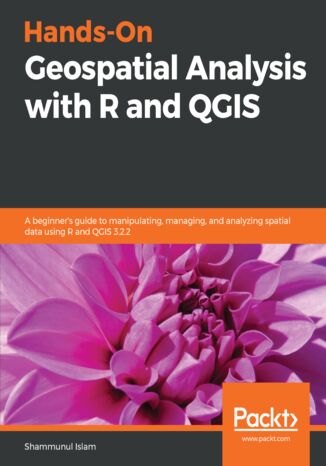
Hands-On Geospatial Analysis with R and QGIS. A beginner’s guide to manipulating, managing, and analyzing spatial data using R and QGIS 3.2.2 Shammunul Islam

- Autor:
- Shammunul Islam
- Wydawnictwo:
- Packt Publishing
- Ocena:
- Stron:
- 354
- Dostępne formaty:
-
PDFePubMobi
Opis
książki
:
Hands-On Geospatial Analysis with R and QGIS. A beginner’s guide to manipulating, managing, and analyzing spatial data using R and QGIS 3.2.2
This book is your companion for applying machine learning algorithms on GIS and remote sensing data. You’ll start by gaining an understanding of the nature of spatial data and installing R and QGIS. Then, you’ll learn how to use different R packages to import, export, and visualize data, before doing the same in QGIS. Screenshots are included to ease your understanding.
Moving on, you’ll learn about different aspects of managing and analyzing spatial data, before diving into advanced topics. You’ll create powerful data visualizations using ggplot2, ggmap, raster, and other packages of R. You’ll learn how to use QGIS 3.2.2 to visualize and manage (create, edit, and format) spatial data. Different types of spatial analysis are also covered using R. Finally, you’ll work with landslide data from Bangladesh to create a landslide susceptibility map using different machine learning algorithms.
By reading this book, you’ll transition from being a beginner to an intermediate user of GIS and remote sensing data in no time.
Wybrane bestsellery
Packt Publishing - inne książki
Dzięki opcji "Druk na żądanie" do sprzedaży wracają tytuły Grupy Helion, które cieszyły sie dużym zainteresowaniem, a których nakład został wyprzedany.
Dla naszych Czytelników wydrukowaliśmy dodatkową pulę egzemplarzy w technice druku cyfrowego.
Co powinieneś wiedzieć o usłudze "Druk na żądanie":
- usługa obejmuje tylko widoczną poniżej listę tytułów, którą na bieżąco aktualizujemy;
- cena książki może być wyższa od początkowej ceny detalicznej, co jest spowodowane kosztami druku cyfrowego (wyższymi niż koszty tradycyjnego druku offsetowego). Obowiązująca cena jest zawsze podawana na stronie WWW książki;
- zawartość książki wraz z dodatkami (płyta CD, DVD) odpowiada jej pierwotnemu wydaniu i jest w pełni komplementarna;
- usługa nie obejmuje książek w kolorze.
Masz pytanie o konkretny tytuł? Napisz do nas: sklep@ebookpoint.pl
Książka drukowana









Oceny i opinie klientów: Hands-On Geospatial Analysis with R and QGIS. A beginner’s guide to manipulating, managing, and analyzing spatial data using R and QGIS 3.2.2 Shammunul Islam
(0)