ODBIERZ TWÓJ BONUS :: »

Python Geospatial Analysis Cookbook. Over 60 recipes to work with topology, overlays, indoor routing, and web application analysis with Python

Język publikacji: angielskim
Python Geospatial Analysis Cookbook. Over 60 recipes to work with topology, overlays, indoor routing, and web application analysis with Python Michael Diener, Michael R Diener - okladka książki
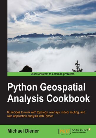
Python Geospatial Analysis Cookbook. Over 60 recipes to work with topology, overlays, indoor routing, and web application analysis with Python Michael Diener, Michael R Diener - okladka książki

Ocena:
Bądź pierwszym, który oceni tę książkę
Stron:
310
Dostępne formaty:
     PDF
     ePub
     Mobi

Ebook 29,90 zł najniższa cena z 30 dni

159,00 zł (-10%)
143,10 zł

Dodaj do koszyka lub Kup na prezent Kup 1-kliknięciem

29,90 zł najniższa cena z 30 dni

Przenieś na półkę

Do przechowalni

Wybrane bestsellery

O autorach książki

Michael Diener graduated from Simon Fraser University, British Columbia, Canada, in 2001 with a bachelor of science degree in geography. He began working in 1995 with Environment Canada as a GIS (Geographic Information Systems) analyst and has continued to work with GIS technologies ever since. In 2008, he founded a company called GOMOGI that is focused on building web and mobile GIS application with open source tools. In 2011, the focus changed to indoor wayfinding and navigation solutions and building the indrz platform that Michael had envisioned. From time to time, Michael also holds seminars for organizations wanting to explore or discover the possibilities of how GIS can increase productivity and help better answer spatial questions. He is also the creative head of new product development in his company. His technical skills include working with Python to solve a wide range of spatial problems on a daily basis. Through the years, he has developed many spatial applications with Python, including indrz and golfgis, which are two of the products built by his company, GOMOGI. He is also lecturer of GIS at the Alpen Adria University, Klagenfurt, where he enjoys teaching students the wonderful powers of GIS and explaining how to solve spatial problems with open source GIS and Python.

Packt Publishing - inne książki

Zamknij

Przenieś na półkę
Dodano produkt na półkę
Usunięto produkt z półki
Przeniesiono produkt do archiwum
Przeniesiono produkt do biblioteki

Zamknij

Wybierz metodę płatności

Ebook
143,10 zł
Dodaj do koszyka
Sposób płatności